GIS (Geographic Information System) Development Course

Our GIS course provides an excellent opportunity for those looking to enhance their skills in geographic data analysis and mapping.

Unlock new career opportunities, build your future

Next Kickoff:

06.05.2024

Application Deadline: 21.05.2024

  • Level: Beginner, Intermediate

  • Total Session: 966

  • Total Weeks: 23

  • Total Modules: 8

  • Languages: TURKISH,GERMAN

WHY TAKE THIS COURSE?
GIS is a rapidly growing field, and having a background in GIS can open up a wide range of job opportunities in fields such as urban planning, environmental management, transportation, natural resource management, Fiber Optic Infrastructure Planning, Environmental Health, Environmental/Climate Protection, Railway Planning, Network/Wastewater Channel Planning, Central Heating and many others. This course will equip you with both the concepts and the practical skills to land your first job in the most dynamic branch of tech.
1400 +
Job vacancies in Germany
42000 €
Average salary in Germany

Our Partners


REQUIREMENTS

What you will need?

Producing effective solutions requires developing analytical thinking and the ability to identify potential problems and limited situations.

As a part of the GIS team, strong communication and collaboration skills are essential for working seamlessly with developers and other stakeholders.

The ability to work effectively at the computer and maintain focus during this time is essential for our GIS course. Participants will learn to navigate GIS software efficiently while staying focused on the task at hand.

Basic computer knowledge

  • Having basic knowledge about computer components,
  • Being able to use the most fundamental computer programs,
  • Having the ability to deal with basic simple problems that may arise on the computer.
What you will not need?

While beneficial, prior GIS experience is not required. We'll cover testing concepts from scratch.

You will work with the most commonly used GIS programs, but you don't need to have experienced GIS knowledge. Our course will train you on the relevant GIS programs.

This course does not require any prior preparation. Participants of all levels are welcome.
WHAT DOES THE COURSE TEACH?

A geographic information system (GIS) is a system that creates, manages, analyzes, and maps all types of data. GIS connects data to a map, integrating location data (where things are) with all types of descriptive information (what things are like there). This provides a foundation for mapping and analysis that is used in science and almost every industry. GIS helps users understand patterns, relationships, and geographic context. The benefits include improved communication and efficiency as well as better management and decision making. A geographic information system (GIS) is a computer system for capturing, storing, checking, and displaying data related to positions on Earth’s surface. GIS can show many different kinds of data on one map, such as streets, buildings, and vegetation. This enables people to more easily see, analyze, and understand patterns and relationships

WEEKLY SCHEDULE

The course will have a flexible structure that can vary week by week to accommodate the learning content being covered. However, a typical week of the course involves certain activities and content. It should be noted that the course is available in a modular format for those who cannot follow the schedule described below. From Monday till Friday- 5 days in a week. Project work with instructor is between 18:00-22:00.
Lessons 1
Monday
2
Tuesday
3
Wednesday
4
Thursday
5
Friday
Self Learning 13:15 - 16:45 13:15 - 16:45 13:15 - 16:45 13:15 - 16:45 13:15 - 16:45
Live Class (Online) 18:00 - 22:00 18:00 - 22:00 18:00 - 22:00 18:00 - 22:00 18:00 - 22:00
 

Module of the Course

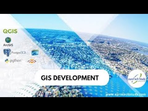
GIS development concepts and tools are covered. Topics include GIS fundamentals, geospatial analysis, web GIS development, database management, programming for GIS, and data visualization. Tools such as ArcGIS, QGIS, web mapping libraries, and spatial databases are utilized. Develop proficiency in GIS development for various applications.

GIS (Geographic Information System) Development Course

Click on Modules!
  • 1Module
  • 2Module
  • 3Module
  • 4Module
  • 5Module
  • 6Module
  • 7Module
  • 8Module
1Module
IT Fundamentals
The aim of this module is to provide participants with basic computer knowledge and introduce them to the computer programs they will need during the course.
2Module
QGIS
The aim of the QGIS module is to equip participants with the ability to effectively use the QGIS (Quantum GIS) program. This module focuses on providing participants with practical skills in the field of Geographic Information Systems (GIS) by covering the basic features, tools, and functions of QGIS.
3Module
ArcGIS
The aim of the ArcGIS Pro module is to equip participants with the ability to effectively use the ArcGIS Pro program. This module focuses on providing participants with practical skills in the field of Geographic Information Systems (GIS) by covering the basic features, tools, and functions of ArcGIS Pro.
4Module
Planning of fiber optic networks, GIS NB and GIS permits
The aim of the Fiber Optic Module is as follows:
  • To teach participants the basic concepts of fiber optics.
  • To prepare participants for project preparation within the framework of fiber optic planning concepts and subsequently prepare a sample project.
  • To instruct participants on how to prepare documents and relevant formats for government-supported projects when applying for government support.
  • To teach participants how to obtain the necessary work permits from the relevant authorities for the area where the project will be implemented.
5Module
PostgreSQL and PostGIS
The aim of the PostgreSQL module is to equip participants with the knowledge, skills, and abilities to process, evaluate, and analyze large geographic data using PostGIS and PostgreSQL, and to create at least intermediate-level queries.

This module focuses on providing participants with practical skills in utilizing, processing, and analyzing geographic information system (GIS) data in the database, including the use of PostgreSQL queries and functions.

6Module
Python for GIS
The aim of the Python module is to introduce participants to basic Python commands and libraries that can be used in the GIS field, and to provide practical skills, especially in creating GUIs in ArcGIS Pro using Python commands.
7Module
CV / Motivation Letter Preparation and Job Application Training
The aim of the CV / Motivation Letter Preparation and Job Application Training module is to focus on preparing and editing the necessary CVs / Motivation letters for participants to enter the business world and on the technical skills required in job interviews.
8Module
Company Internship
The aim of the Company Internship module is to engage participants in working in a real company environment in Germany with real field data, reinforcing the use of GIS programs during this time, and preparing them for the production of GIS projects.
 

Career Services

We design students' career paths from the ground up. We prepare them for work by following a systematic program that includes everything from selecting the right course to providing quality education and teaching soft skills.

CV & Profile Preparation

The first step in our career assistance will be to assist you in developing a solid CV and an impressive profile. Our experts will work with you to create a CV and profile that best exposes you and captures the attention of employers. This will help you build a solid foundation that will help you stand out during the job search process.

Preparing for the Interview

Second, we will assist you in improving your interviewing skills. You will be more confident and prepared for the interview this way. Our professional career coaches will conduct our interview simulation service, and you will be able to enhance your specific interview abilities with feedback.

Workshop and Alumni Meeting

Third, we will arrange seminars and events with the involvement of our graduates and industry professionals. These events will give you with a vital opportunity to stay current on industry trends and learn new knowledge. You will also be able to broaden your network by meeting business people.

HOW OUR APPLICATION PROCESS WORKS?

1
Step
Application Form
Fill in our Application Form with your personal details and get immediate access to the coding challenge.
2
Step
Make an Appiontment
To measure your skills for the course you are applying for, book a time slot that suits you from our education consultant's calendar.suits you from our education consultant's calendar.
3
Step
Data Challenge
Take a 30-minute online quiz and prove your skills. If you're just starting out, don't worry. This exam only aims to find out your current level.

GRADUATION CERTIFICATE

Students who successfully complete the course will be eligible to receive a certificate. Additionally, after completing the Fiber Optic Module, each student is required to prepare a project and submit projects as a condition for completing the course. The certificate verifies to prospective or future employers that skills in GIS programs have been acquired. Expect this to be part of your resume or profile related to GIS.
//

Got Any Questions?

You can join the course without any prior GIS knowledge or experience. Both beginners and those looking to improve their existing skills are welcome.

Yes, you can. Education vouchers from Business Center are valid for our courses.

Your computer must be Windows-based. Additionally, the minimum requirements for the computer are as follows:

  • RAM: At least 8 GB of RAM is recommended.
  • HDD: At least 256 GB of storage space is recommended.
  • Processor: An Intel Core i5 or equivalent processor is recommended.
  • Processor Speed: A minimum processor speed of 2.5 GHz is recommended.
  • Second Screen: Using a second screen is recommended.
  • Headphones and Microphone: Headphones and a microphone are required for communication.
  • Internet Connection: A stable internet connection is required.

The lessons are conducted on Webex.

After completing the course, you can apply for positions such as:

  • Fiber Optic Planner
  • Network Planner
  • GIS Specialist
  • GIS Specialist
  • Data Entry Specialist GIS
  • Geomatician
  • GIS Expert
  • GIS Analyst
  • Specialist in the field of Geoinformatics / Cartography

and similar positions.

Our bootcamp can be financed by the Agentur für Arbeit and the JobCenter with Bildungsgutshein. In addition, private payments and installment options are available. Do not hesitate to contact us.

In the last month of your training, we will work on your personal interview and technical interview. Technical mock interviews will be our last exercise to prepare you for your real interviews. After the bootcamp, we keep in touch with our graduates on our discord channel. In this channel, we actively communicate about job opportunities and interview experiences. You can also find the announcements of our upskills courses for market needs and you can also participate in these courses.

During the bootcamp, each student can prepare for the job search process step by step with his/her own account through the training portal on our website www.career.eurotechstudy.com. Of course you will not be alone in this process, your career coach will help you every step of the way. For more information see https://eurotechstudy.com/en/financings/career-service

GOT QUESTIONS?

How does your background relate to tech? What about transferrable skills, funding options, or career goals? Let's schedule a quick 10 minute call to get all your specific questions answered.

Hear from those who succeeded with euroTech Study

GIS Experiences / Q&A Session 2
euroTech Study GmbH is a Germany-based technology school offering world-class courses and bootcamps for all levels in the most demanding IT fields such as Software Testing Engineering, Cyber Security, Data Science, Back-end and Front-end Web Development, Geographical Information Systems.
GIS Experiences / Q&A Session
euroTech Study GmbH is a Germany-based technology school offering world-class courses and bootcamps for all levels in the most demanding IT fields such as Software Testing Engineering, Cyber Security, Data Science, Back-end and Front-end Web Development, Geographical Information Systems.